Category:Public transport maps of Auckland
Jump to navigation
Jump to search
Media in category "Public transport maps of Auckland"
The following 12 files are in this category, out of 12 total.
-
 Auckland proposed rail network following CRL completion - updated 2022.png 2,169 × 1,950; 411 KB
-
 Auckland proposed rail network following CRL completion.png 8,675 × 7,796; 2.08 MB
-
Auckland public transport animated map - low quality.ogv 2 min 6 s, 384 × 288; 2.15 MB
-
Auckland public transport animated map.ogv 2 min 6 s, 1,280 × 720; 35.18 MB
-
 Auckland Rail Map.svg 1,388 × 1,248; 112 KB
-
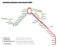
 Auckland Rail Network.png 1,818 × 545; 439 KB
-
 AucklandFerryRoutes.png 659 × 573; 44 KB
-
 AucklandRailMap.png 1,388 × 1,248; 226 KB
-
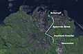
 CBD Tunnel Landsat 7 Image Auckland.jpg 1,000 × 660; 160 KB
-
 Central Connector Landsat 7 Image Auckland.jpg 1,000 × 660; 162 KB
-
 Post CRL draft rail network.png 3,339 × 2,684; 560 KB
-
 Post CRL draft rail network.svg 673 × 461; 164 KB


